Lysebotn & Surrounding Area, Norway
It has to be said that this next stage of our trip was some of the best days and experiences that we had experienced thus far. Our introduction to this leg was looking at the SatNav and noticing that the distances between destinations were decreasing, but the travel time was increasing. The roads looked less like A-roads and more like someone had dropped spaghetti.
As we left Stavanger behind us, we headed towards our next big destination, Lysebotn. We again chose the tourist route Fv45. This was considered a main road, and for the majority of the first hour it offered wide carriageways enough for two vehicles to easily pass. The scenery was absolutely stunning as we passed by Oltedalsvatnet, Oltedal and Frafjorden (Dirdal) on the way to our Camp4Nite overnight stopover.
As we approached, we slowed in order find the end of the 1/4 mile track that led to a small car park. As we pulled on to the gravel, we found two other motorhomes settling in for the night. Once we stopped, we were quickly approached by a local family of sheep. They came rushing over, I think hoping for us to feed them, and the noise of the small bell around the mother’s neck was a lovely sound in the near silent surroundings. It was a great place to stop and rest before the trip on towards Lysebotn and our intention to hike up to Kjerag.

Sheep-Bell Camping Spot, Hunnevatn, Norway
We were up early the following day and had a quick breakfast, packed away and were on the road soon after. We had two aims that day, one was to get to hike up to Kjerag and the other was to get on the last ferry of the day from Lysebotn to deliver us to Forsand. We were on the clock.
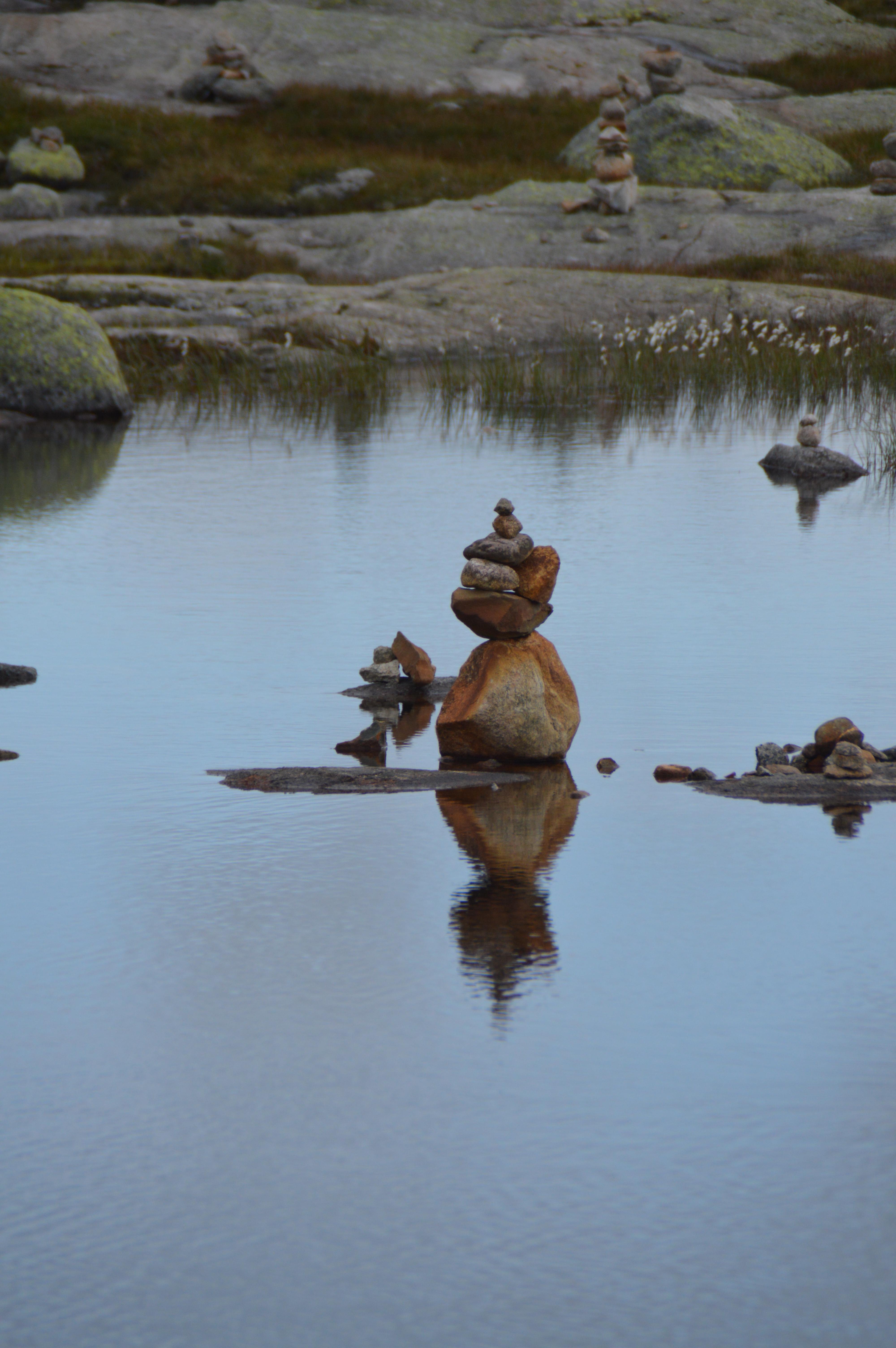
The drive between our overnight stop and the car park to climb to Kjerag was rugged, stunning, ethereal… the superlatives could go on an on for this area… and for the whole of the Fjordlands of Norway. We took a brief stop to take in some of the sights of the high altitude lakes and captivating stone towers. I know we have seen them in most coastal areas during our travels, but somehow many of these appeared to be almost sculptures.
Person reflecting on life, Tjørhom, Norway
We did not have time to stop long, so we enjoyed the brief but tranquil interlude, and then headed on through the mountain passes and valleys to the carp park at Kjerag Cafe & Restaurant (Ørneredet). As we arrived, the clouds above us looked ominous and everything we had read instructed us to prepare for anything. We packed a rucksack with food, water, warm fleeces, waterproofs and a camera (in a waterproof bag). We donned our trail shoes and walked to the head of the trail following a German couple with their two children who had parked up next to us. The kids were 6 and 8.
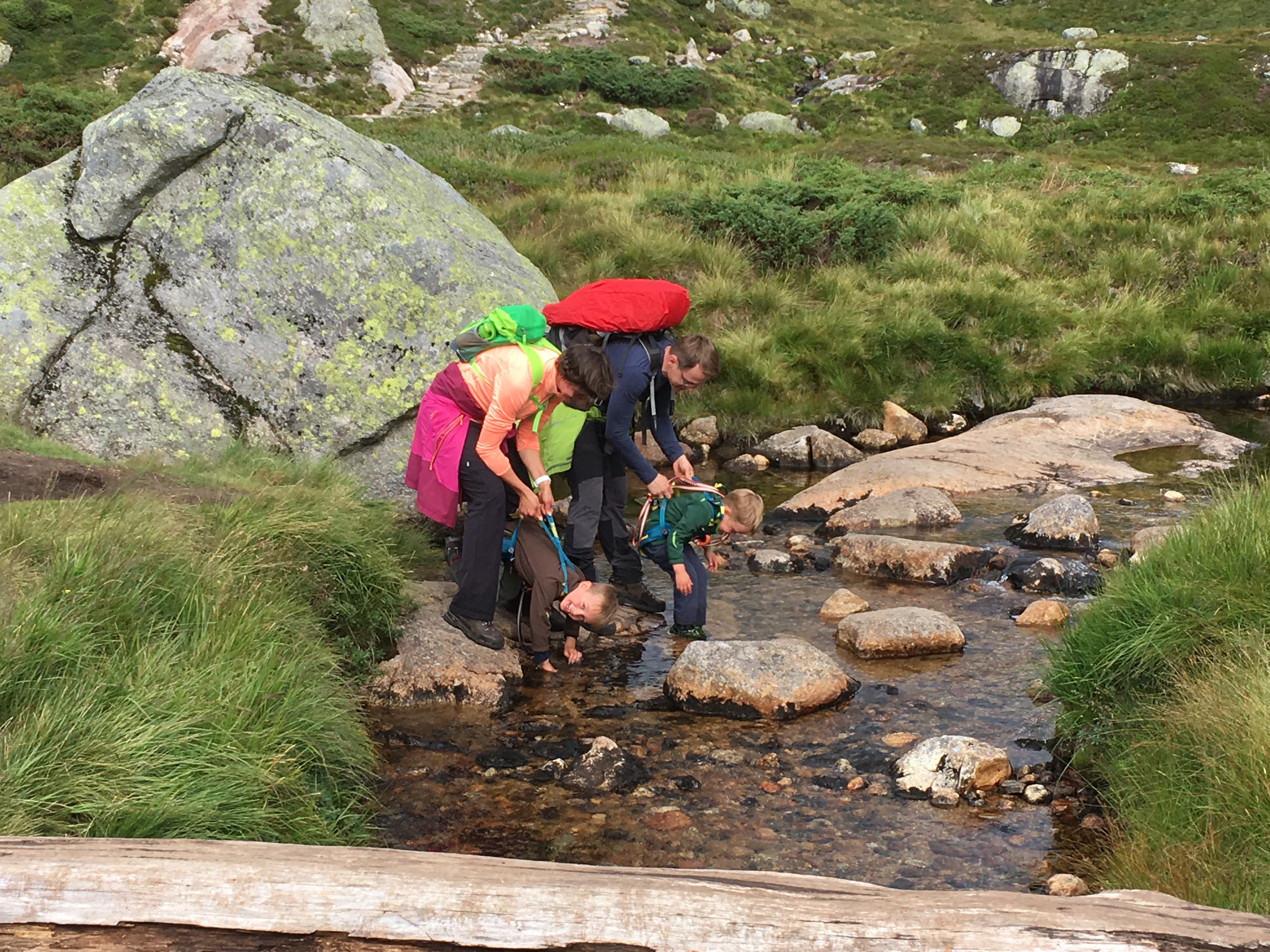
Our new friends playing in one of the streams on the way back from Kjerag, Norway
It looked a forbidding initial climb with no sign of a pathway, just piles of rocks with a red sprayed cross every 100-150 yards. Before we started, the guide at the head of the trail had given us a briefing on the conditions, distance and difficulty rating, not to be deterred, we headed for the first climb. We ended up following them most of the way throughout the hike. We quickly struck up a conversation with them as we were fascinated that they were taking such young children on a challenging trek. The were obviously a fit family, and well equipped for what lay ahead.
Needless to say, the hike was certainly a challenge, with many sections reducing us to a crawl (literally in places) and some being in excess of 45 degree inclines with chains to help hikers up to the next plateau. The hike consists of 3 inclines, each one raising you further and further above the valley below.
After about 3.5hrs, Kjerag finally came in to view, well the signpost anyway. The last 100m scale down, what can only be described as a waterfall made of rocks, was slow work, but the view at the end was worth it. As we rounded the last rock, our new German friends were just sitting down to feed the kids. We noticed that some people were venturing out to the edge and the brave were standing on the famous Kjeragbolten.
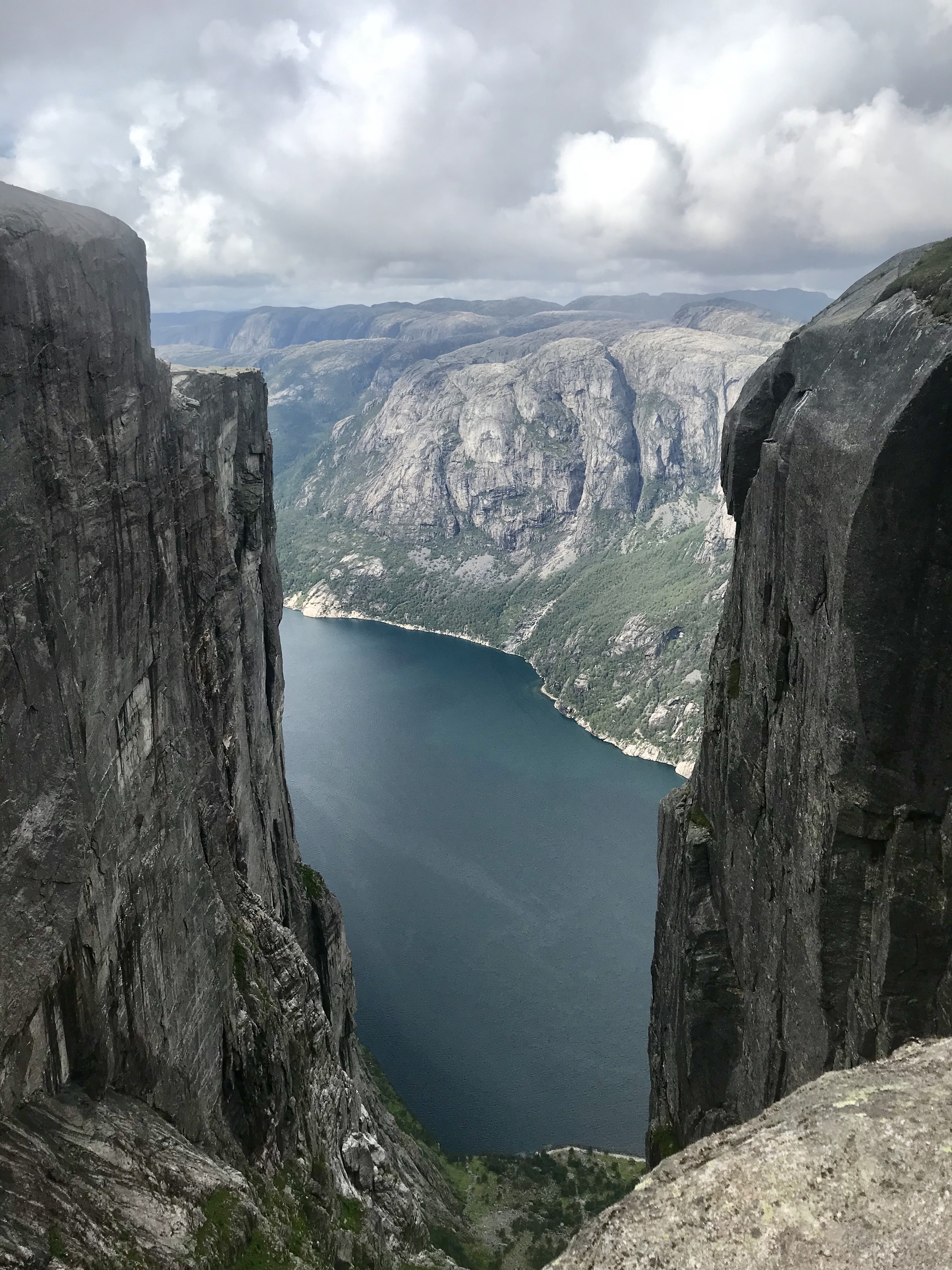
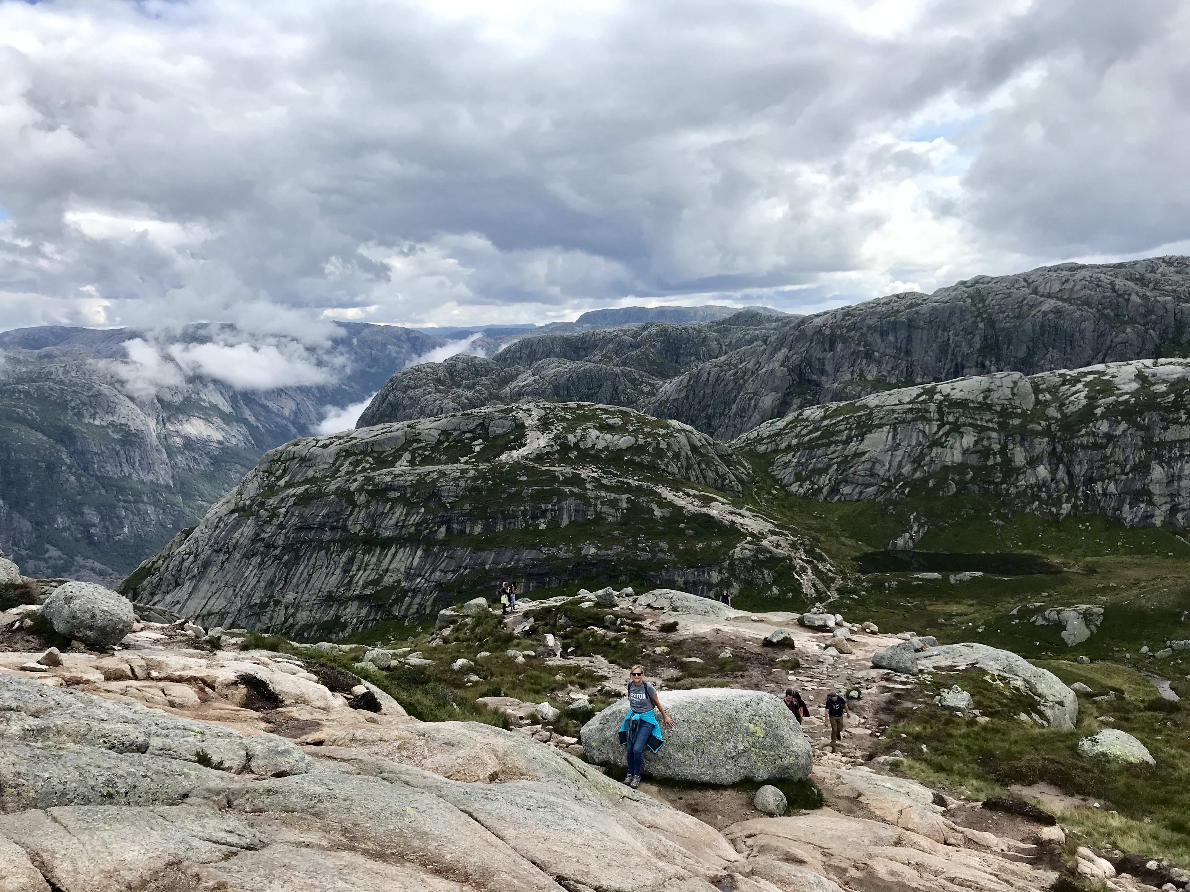
The view down to Lysefjorden from near Kjerag, Norway
Well… while I was there, I felt that I had to bury my fear of heights and just get out there. The German dad kindly offered to take our picture to record the moment. However, although I was encouraging Sarah, she wasn’t quite brave enough to come out on the rock. If you look carefully in the second picture, you can see her feet hovering next to the boulder.

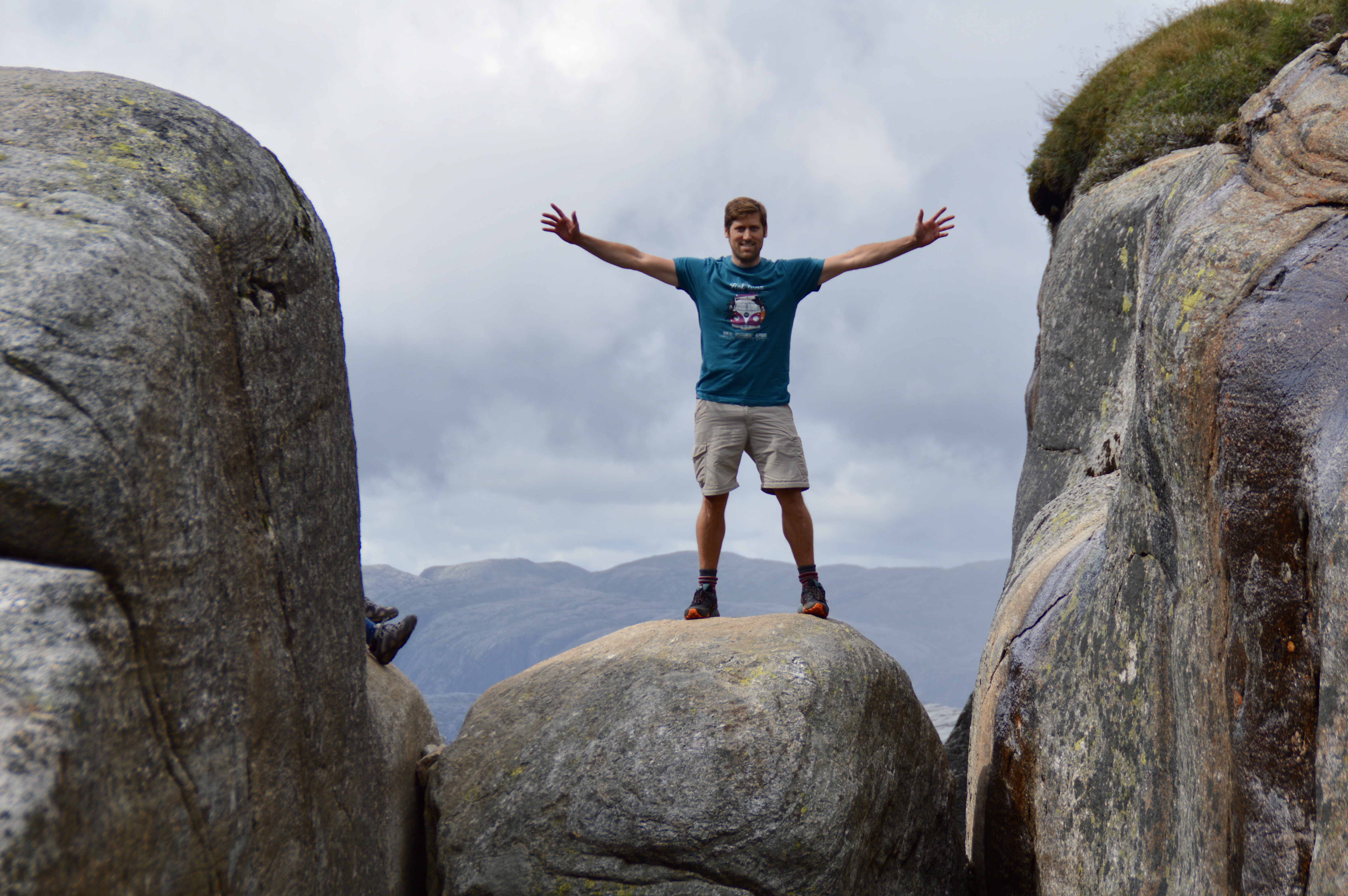
Kjeragbolten, Norway
Sarah's feet can just be seen hovering over the bolder on the left, Kjeragbolten, Norway
After the exhilaration of standing 1100m (3600ft) above a vertical drop to the valley below, the weather quickly changed with the cloud and moisture blowing up from the valley below. The bolder and the view were quickly disappearing in front of our eyes and the rain was starting to fall heavily. So we decided to optic up, get our waterproof gear on and head on the trail back to the car. We knew we were up against it on time and that the visibility was dropping rapidly below 100m. As a result, we really got our stomp on and tried to keep pace with the German family and the 2-3 groups that had left Kjerag at a similar time. We felt it was safety in numbers, plus we learnt that one of the groups contained a man currently serving in the military. He seemed confident and self-assured in the conditions.

Post rain storm look - very pleased with ourselves (even if we weren't back yet), on the return from Kjerag, Norway
The return leg was more challenging than the outbound leg, but we kept a good pace, stopped infrequently and ended up making good times. I was so proud of Sarah! She had managed to complete the 6.5hr hike, climbing over 745m (2450ft) and covering over 10.5km (6.6 miles).
The route to Kjerag, Norway
As we arrived back at the motorhome, we had little time to celebrate our achievement before we had to change shoes, dump our wet gear in the back and descend the 27 hairpin bends to Lysebotn below. The descent was made even worse as the storm decided to erupt above us and the rain was so hard that the road quickly became a river. By the time we reached the bottom, my knuckles were white from gripping the steering wheel so tightly… plus there was the smell over burning brakes too even though I had been trying to be kind to them by utilising engine braking as much as possible.
We made the ferry with a couple of minutes to spare! Literally. As we joined the end of the queue, the person came to check our booking details and then we were embarking to ferry to Forsand.
Once parked up, we grabbed a few of our things and headed up on to the deck. As we absorbed the view down the fjord, we were afforded the first chance to recognise the achievement of hiking to Kjerag and standing on the bolder above the valley floor.

Lysefjorden, Norway
During the cruise back through Lysefjorden we got the opportunity to look back up towards our hiking destination. We also got the chance to watch an impending storm come up the fjord towards us. As this was a cruise and a ferry, the commentary was really very interesting learning a great deal about local folklore and history.

Lysefjorden, Norway
We arrived in Forsand spot on time. As we headed away from the small dock, we decided to pick an off-grid camping spot by the sea to eat, rest and sleep.
As we headed on past Jørpeland, Sarah found what sounded like an ideal place to stop. It sounded like it would be perfect and, as it was off the beaten track, we felt that it would likely be quiet. There were a few surprises in store in the last 2.5km (1.5 miles) of our day. After only about 0.5km the tarmac simply ran out and we had to follow a gravel track between two farm houses on towards the coast. We were unsure we were going the right way, but decided to push on anyway. As we emerged from the fields on to the coast, we found the gravel parking area that Sarah had selected and found the view to be stunning. However, we were not alone, there must have been 12-14 other campers of all sorts lined up along the edge of the rocky coastline, Considering how many others were there, it was such a quiet and beautiful spot to watch as the sunset shortly after our arrival. The perfect end to an amazing day. The beer that awaited me felt well earned!

Off-grid camping spot near Jørpeland, Norway
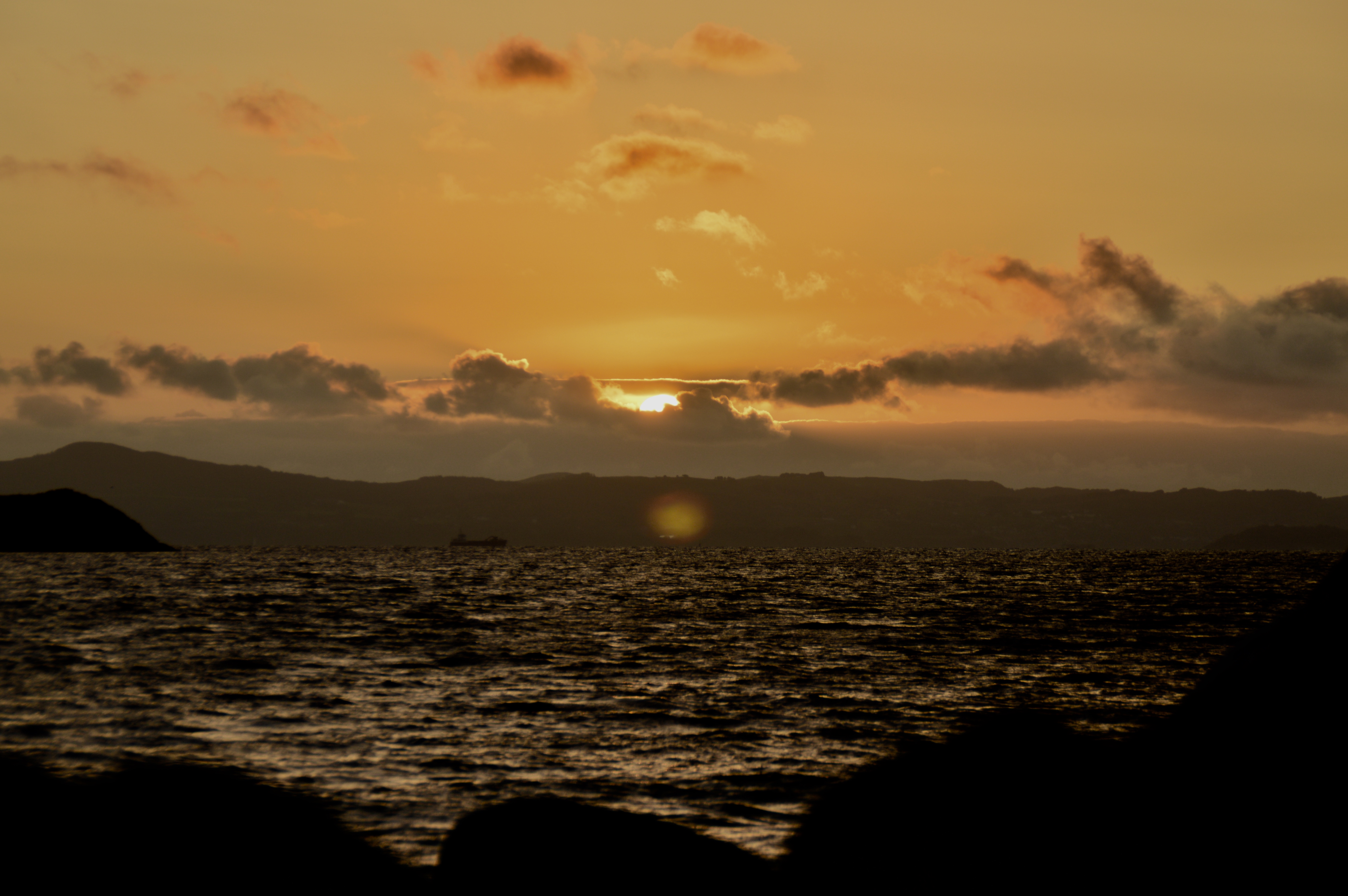
View as the sun was setting from our off-grid camping spot near Jørpeland, Norway